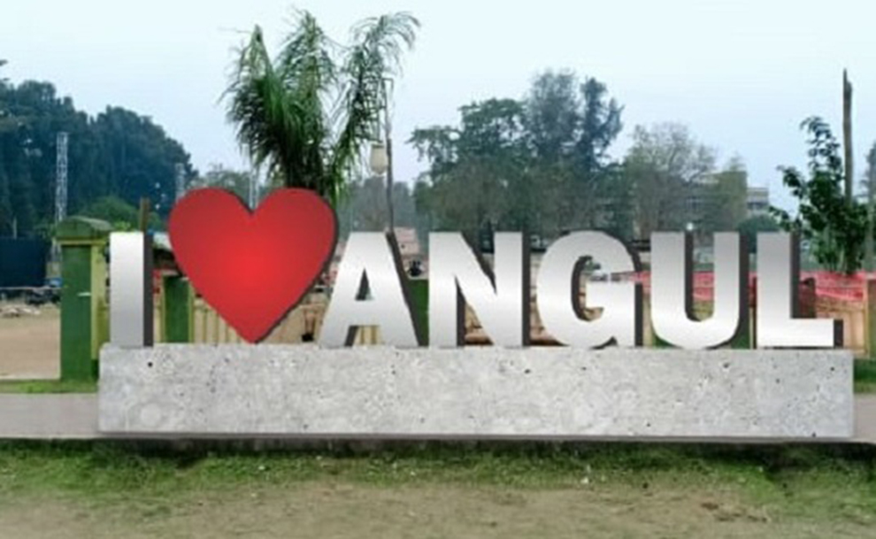
Angul district came into existence as a separate district consequent upon reorganization of districts in Orissa on 1st April 1993,clothed with lush green forests. The district is rich in wildlife .The River Mahanadi passes through the district forming a 22 km long narrow gorge, one of the mistiest gorges in India, popularly Satkosia. The district is surrounded by Cuttack and Dhenkanal in the east, Sambalpur and Deogarh in the west, Sundergarh and Keonjhar in the north and Kandhamal in the south.
9 Facts About Angul District
#1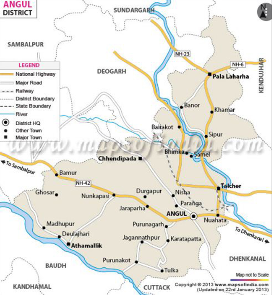 The District of Angul situated at the heart of Odisha was a part of Undivided Dhenkanal District till early March 1993, but for the administrative convenience, Dhenkanal District was divided into two parts i.e. Dhenkanal and Angul vide State Government Notification No. DRC-44/93/14218/R. dated 27 March 1993. Angul District came into existence as a separate District on April 1, 1993. The District is surrounded by Cuttack & Dhenkanal on the east, Sambalpur & Deogarh on the west, Sundargarh & Keonjhar on the north and Phulbani on the south. Covering an area of 6232 sq.km, Angul District is located at Latitude 20.50 North to 85.00 East Longitude.The altitude of this place is 564 to 1187 mts.ated at the heart of Odisha was a part of Undivided Dhenkanal District till early March 1993, but for the administrative convenience, Dhenkanal District was divided into two parts i.e. Dhenkanal and Angul vide State Government Notification No. DRC-44/93/14218/R. dated 27 March 1993. Angul District came into existence as a separate District on April 1, 1993. The District is surrounded by Cuttack & Dhenkanal on the east, Sambalpur & Deogarh on the west, Sundargarh & Keonjhar on the north and Phulbani on the south. Covering an area of 6232 sq.km, Angul District is located at Latitude 20.50 North to 85.00 East Longitude.The altitude of this place is 564 to 1187 mts.
Field
The District of Angul situated at the heart of Odisha was a part of Undivided Dhenkanal District till early March 1993, but for the administrative convenience, Dhenkanal District was divided into two parts i.e. Dhenkanal and Angul vide State Government Notification No. DRC-44/93/14218/R. dated 27 March 1993. Angul District came into existence as a separate District on April 1, 1993. The District is surrounded by Cuttack & Dhenkanal on the east, Sambalpur & Deogarh on the west, Sundargarh & Keonjhar on the north and Phulbani on the south. Covering an area of 6232 sq.km, Angul District is located at Latitude 20.50 North to 85.00 East Longitude.The altitude of this place is 564 to 1187 mts.ated at the heart of Odisha was a part of Undivided Dhenkanal District till early March 1993, but for the administrative convenience, Dhenkanal District was divided into two parts i.e. Dhenkanal and Angul vide State Government Notification No. DRC-44/93/14218/R. dated 27 March 1993. Angul District came into existence as a separate District on April 1, 1993. The District is surrounded by Cuttack & Dhenkanal on the east, Sambalpur & Deogarh on the west, Sundargarh & Keonjhar on the north and Phulbani on the south. Covering an area of 6232 sq.km, Angul District is located at Latitude 20.50 North to 85.00 East Longitude.The altitude of this place is 564 to 1187 mts.
#2 The district has an area of 6375 sq. kms and 12.74 lakhs of population as per 2011 census. The district accounts for 4.1 percent of the states territory and shares 3.0 percent of the states population. The density population of the district is 200. per sq. kms. as against 270 person per sq. km. of the state. It has 1910 villages (including 249 un-inhabited villages) covering 8 blocks. 8 Tahasils and 4 Subdivisions. As per 2011 census the schedule caste population is 2,39,552 (18.80 %) and schedule tribe population is 1,79,603 (14.10.%). The literacy percentage of the district constitutes 77.50 against 72.90 of the state.
Population
The district has an area of 6375 sq. kms and 12.74 lakhs of population as per 2011 census. The district accounts for 4.1 percent of the states territory and shares 3.0 percent of the states population. The density population of the district is 200. per sq. kms. as against 270 person per sq. km. of the state. It has 1910 villages (including 249 un-inhabited villages) covering 8 blocks. 8 Tahasils and 4 Subdivisions. As per 2011 census the schedule caste population is 2,39,552 (18.80 %) and schedule tribe population is 1,79,603 (14.10.%). The literacy percentage of the district constitutes 77.50 against 72.90 of the state.
#3 The locational .advantage and abundant stock of manpower and raw materials have played an important role in the industrial development of the district. The important PSUS of the district are the NALCO, the MCL. Besides during the year 2010-11.,185 nos. of small scales Industries have been Established with total capital investment of about Rs 1933.00 lakhs with 724 nos of Employment generated in Angul district. Besides various kinds of handicraft works like dhocra casting , bell metals , textile products have been developed by the skilled workers and
artisans of the district.
The locational .advantage and abundant stock of manpower and raw materials have played an important role in the industrial development of the district. The important PSUS of the district are the NALCO, the MCL. Besides during the year 2010-11.,185 nos. of small scales Industries have been Established with total capital investment of about Rs 1933.00 lakhs with 724 nos of Employment generated in Angul district. Besides various kinds of handicraft works like dhocra casting , bell metals , textile products have been developed by the skilled workers and
artisans of the district.
Number Of Block
The locational .advantage and abundant stock of manpower and raw materials have played an important role in the industrial development of the district. The important PSUS of the district are the NALCO, the MCL. Besides during the year 2010-11.,185 nos. of small scales Industries have been Established with total capital investment of about Rs 1933.00 lakhs with 724 nos of Employment generated in Angul district. Besides various kinds of handicraft works like dhocra casting , bell metals , textile products have been developed by the skilled workers and
artisans of the district.
#4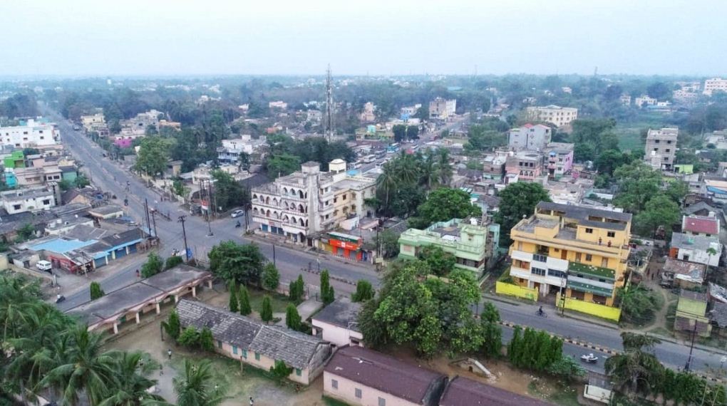 There are 230 towns and villages available in district Angul from the state Odisha, India. Complete list of all areas along with their pin codes in Angul district of Odisha.According to Census 2011 information the location code or village code of Angul village is 379875. Angul village is located in Jharbandha tehsil of Bargarh district in Odisha, India. It is situated 12km away from sub-district headquarter Jharbandha (tehsildar office) and 130km away from district headquarter Bargarh. As per 2009 stats, Dava is the gram panchayat of Angul village.The total geographical area of village is 1045 hectares. Angul has a total population of 1,106 peoples, out of which male population is 562 while female population is 544. Literacy rate of angul village is 62.12% out of which 71.89% males and 52.02% females are literate. There are about 289 houses in angul village. Pincode of angul village locality is 768039.
Number Of Villages
There are 230 towns and villages available in district Angul from the state Odisha, India. Complete list of all areas along with their pin codes in Angul district of Odisha.According to Census 2011 information the location code or village code of Angul village is 379875. Angul village is located in Jharbandha tehsil of Bargarh district in Odisha, India. It is situated 12km away from sub-district headquarter Jharbandha (tehsildar office) and 130km away from district headquarter Bargarh. As per 2009 stats, Dava is the gram panchayat of Angul village.The total geographical area of village is 1045 hectares. Angul has a total population of 1,106 peoples, out of which male population is 562 while female population is 544. Literacy rate of angul village is 62.12% out of which 71.89% males and 52.02% females are literate. There are about 289 houses in angul village. Pincode of angul village locality is 768039.
#5
Village Panchayat
NUAMAUJA Village RANTALEI Panchayat ANUGUL is situated in Angul District. People of this village are living in very peaceful manner. This village having very proud history. Agriculture is the main profession of this village. Still this village is waiting for Industrial development. Education, Drinking water, Road and Electricity are the main concern of this village. Young generation is more attracted towards mobile, Laptop and computer technology these days. If banks and finance institutions proved loan and other financial support to the villagers, this village will see the real development. Medical and health services has to be improved.
#6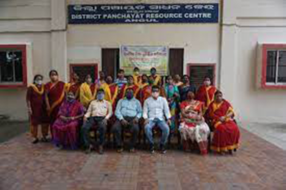 During 2010-11, there are 997 nos. of primary schools 706 nos. of middle schools and 262 nos of Secondary schools and 36 nos. of General Collages are imparting general education. Besides, 2 nos. of Diploma engineering collages are functioning in Angul district to impart technical educations in the district.
Education
During 2010-11, there are 997 nos. of primary schools 706 nos. of middle schools and 262 nos of Secondary schools and 36 nos. of General Collages are imparting general education. Besides, 2 nos. of Diploma engineering collages are functioning in Angul district to impart technical educations in the district.
#7 Mahanadi River and Brahmani River flows through the district of Angul making it fertile. Various natural resources are found in abundance in Angul District and make a major contribution to the maximum amount of revenues to the state government. It is because of this reason that it is considered as the most strategically advanced district.
Flowing River
Mahanadi River and Brahmani River flows through the district of Angul making it fertile. Various natural resources are found in abundance in Angul District and make a major contribution to the maximum amount of revenues to the state government. It is because of this reason that it is considered as the most strategically advanced district.
#8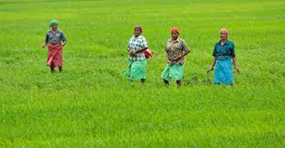 During the year 2010-11 the net area sown was 105 thousand hectares against 4681 thousand hectares of the state. The production of paddy was 729024 quintals, Wheat 529 quintals, maize 8906 quintals, ragi 22 quintals, mung 6702 quintals, biri 8490 quintals, kulthi 13083 quintals and til 6687 quintals , groundnuts 29524 quintals, mustard 499 quintals, potatoes 46373 quintals and sugarcane 55385 quintals. During 2010-11 the total fertilizers used in Angul district is about 10027 MT with a breakage of 5881 M.T. nitrogenous, 2790 M.T. phosphatic, 1356 MT pottasic and the consumption of fertilizer per hectare is 34 Kg. per hectare.
Agriculture
During the year 2010-11 the net area sown was 105 thousand hectares against 4681 thousand hectares of the state. The production of paddy was 729024 quintals, Wheat 529 quintals, maize 8906 quintals, ragi 22 quintals, mung 6702 quintals, biri 8490 quintals, kulthi 13083 quintals and til 6687 quintals , groundnuts 29524 quintals, mustard 499 quintals, potatoes 46373 quintals and sugarcane 55385 quintals. During 2010-11 the total fertilizers used in Angul district is about 10027 MT with a breakage of 5881 M.T. nitrogenous, 2790 M.T. phosphatic, 1356 MT pottasic and the consumption of fertilizer per hectare is 34 Kg. per hectare.
#9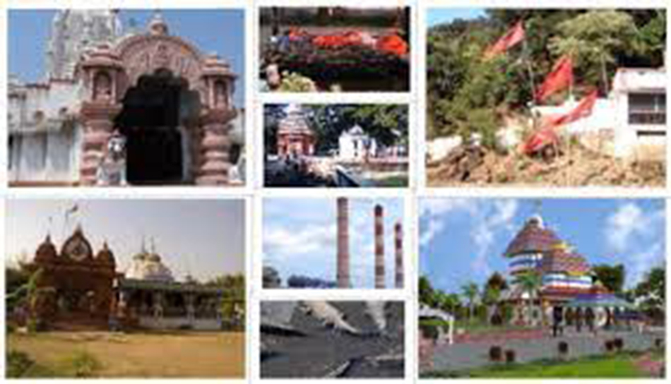 There are 12 nos. of tourist center such as Angul, Banarpal, Bhimkand, Benikei,
Bulajhar, Deulajhari, Tikarapada, Talchar, Handapa patrapada, Hingulapitha, khuladi Rengali as
identified by Department of Tourism and culture, Orissa. During 2011 the number of Domestic
tourists were 584657 and foreign tourists were 316 who visited the tourists sports of the district.
There are 12 nos. of tourist center such as Angul, Banarpal, Bhimkand, Benikei,
Bulajhar, Deulajhari, Tikarapada, Talchar, Handapa patrapada, Hingulapitha, khuladi Rengali as
identified by Department of Tourism and culture, Orissa. During 2011 the number of Domestic
tourists were 584657 and foreign tourists were 316 who visited the tourists sports of the district.
Tourist destination
There are 12 nos. of tourist center such as Angul, Banarpal, Bhimkand, Benikei,
Bulajhar, Deulajhari, Tikarapada, Talchar, Handapa patrapada, Hingulapitha, khuladi Rengali as
identified by Department of Tourism and culture, Orissa. During 2011 the number of Domestic
tourists were 584657 and foreign tourists were 316 who visited the tourists sports of the district.
Ad Area


